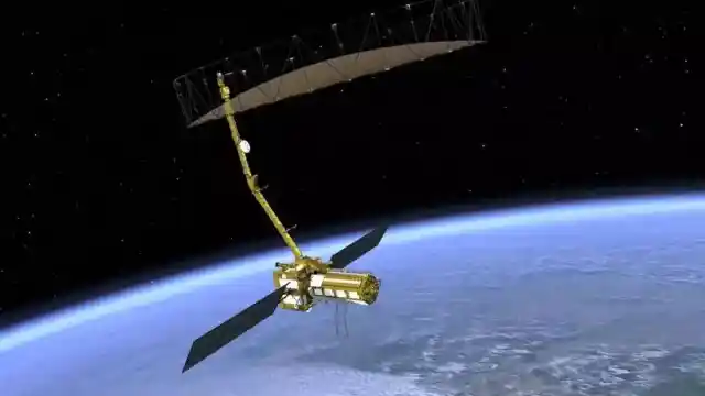
NISAR, the first joint satellite developed by NASA and ISRO, is scheduled for launch on July 30 at 5:40 p.m. from the Satish Dhawan Space Centre, Sriharikota. The satellite will be deployed into a 743 km Sun-synchronous orbit by the GSLV-F16 rocket.
Dual-Frequency Radar for First Time
Weighing 2,392 kg, NISAR will be the first satellite in the world to use a dual-frequency Synthetic Aperture Radar (SAR), combining NASA’s L-band and ISRO’s S-band radars. The mission will also feature NASA’s 12-meter unfurlable mesh reflector antenna, integrated with ISRO’s modified I3K satellite bus.
High-Resolution, All-Weather Monitoring
NISAR will scan the Earth with a 242 km swathe and provide high spatial resolution data using SweepSAR technology. It will observe Earth in all weather conditions, day and night, with 12-day repeat cycles, offering precise insights on environmental changes.
Wide Range of Applications
The satellite will detect surface changes, including ground deformation, ice sheet movement, and vegetation shifts. Other key applications include:
- Sea ice classification
- Storm tracking
- Shoreline and ship monitoring
- Soil moisture changes
- Surface water mapping
- Disaster management support
Result of Decade-Long Collaboration
NISAR is a product of over a decade of collaboration between NASA’s Jet Propulsion Laboratory and multiple ISRO centres. Key contributions include:
- S-band radar from Space Applications Centre (Ahmedabad)
- Spacecraft bus from U.R. Rao Satellite Centre
The mission highlights the growing India-US space partnership and marks a significant step forward in Earth science and global monitoring technologies.